The Tsarist Empire of Gishabrun is divided into federal subjects for easier governance. All populated subjects are called oblasts, and all uninhabited federal subjects are called krais. Every oblast has a seat in the Oblastian Assembly and is semi-autonomous, while the krais are represented by HIM the Tsar in the Elite Duma (since they have no population), and the autonomous regions are represented in the Chamber of Comrades, and have a population and are governed by a separate head of state. Currently, the Empire consists of 6 Oblasts, 4 Krais, and 1 Autonomous Region.
Total Area of Gishabrun: 14793.050637378... square metres
Total Population of Gishabrun: 17 people
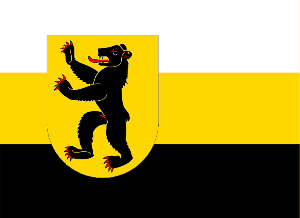
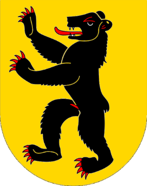
Kravat Oblast
Fact File Symbols
|
Flag: Coat of Arms:
|

Kravat Oblast
Kravat Oblast is the first and oldest oblast in the Tsarist Empire of Gishabrun. It is also the capital and among the most populous oblasts of Gishabrun.
Etymology
The name "Kravat" refers to the previous name of Gishabrun, the "Tsardom of Moya Kravat". The word Kravat means "bed" in Russian, referring to the first territory captured by the micronation.
History
On the 24th of June, 2009, HIM Tsar Kuri I established the Tsardom of Moya Kravat on the territory of his bed, on what is now Kravat Oblastian territory. The rival Principality of Annina Kravat also arose on current Kravat Oblastian land. Then, in May 2010, HIM Tsar Kuri I captured a tiny strip of land, completely surrounded by the Principality of Annina Kravat. This sparked tensions between the two young micronations, and soon after that Anna I of Annina Kravat declared what is now known as the Furnace War. This war resulted in the Principality of Annina Kravat being conquered by Moya Kravat, and Kravat Oblast being founded to distinguish it from Annina Kravat Oblast. Kravat Oblast expanded from just HIM Tsar Kuri I's room to his whole property (except for Annina Kravat), including the National Aquarium and the first regular parks; The Imperial and Front Gardens. On the 26th of July, 2010, Kravat Oblast grew once more to include Annina Kravat Oblasr, since The Council thought it unnecessary for Annina Kravat to remain a separate oblast. On the 15th of August, 2010, Kravat Oblast became the site of the first Gishabruni peerage; The Principality of Annina Kravat. On the 24th of August, 2010, Kravat Oblast held an election for the title of Ambassador, which resulted in HIM Tsar Kuri I being re-elected, and was the first election in Gishabruni history. On the 9th of October, 2010, Kravat Oblast was twinned with Patetopia City, in the Republic of Patetopia. On the 9th of December, 2010, Kravat Oblast absorbed The Stig Oblast, with the previous areas of the two oblasts becoming Communes with the same names as the former oblasts, with Jeremy Clarksoon becoming the first Mayor of the Commune of The Stig, and the Mayor of the Commune of Kravat being vacant, decided by a domestic election. The two communes became the first examples of oblastian lesser districts in Gishabrun. On the 10th of December, 2010, the Commune of The Stig (and therefore Kravat Oblast) grew to include the whole property of Jeremy. On the 16th of December, 2010, Anna I, former Princess of Annina Kravat, became the Lord-Mayor of the Commune of Kravat. On the 20th of December, 2010, French became the fourth recognised regional language of Gishabrun, with fluent speakers living in Kravat Oblast. Somtime in April 2011, the Commune of The Stig became its' own oblast once again, under the name "The Stig" and the Ambassadorship of Jeremy Clarksoon, which was later removed from Gishabrun on the grounds of inactivity. On the 21st of February, 2012, Kravat Oblast aquired its first assigned Overseas Subject, namely Samuel Krimmer.
Geography and Climate
The Kravat Oblastian climate is continental (but modified by the nearby river with the Lake Effect), meaning it has an average of 9.5 degrees Celsius, with 133.1 cm of snowfall each winter and 834 mm of precipitation year-round. Kravat Oblast is on the edge of a small valley, and has a steep cliff right outside the borders, Kravat Oblast contains the National Aquarium, HIM the Tsar's Residence, The Imperial and Front Gardens, and the headquarters of most Gishabruni agencies,. Kravat Oblast is surrounded by Canada on all sides. Kravat Oblast is ? square metres.
Sister Cities
- Commune of Kravat - Patetopia City, Republic of Patetopia
Somewhere Oblast
Fact File Symbols
|
|
Flag:
Coat of Arms:
|


Somewhere Oblast
Somewhere Oblast is the second-oldest oblast of the Tsarist Empire of Gishabrun. Somewhere Oblast is also among the largest Gishabruni oblasts in population.
History
On the 8th of July, 2010, HIM Tsar Kuri I captured an area of 10 square metres containing the bedroom of His Elite Excellence, Prince Sovetus, and appointed Sovetus as Ambassador. A few weeks later, Somewhere Oblast expanded to include Sovetus's aquarium, so that he could join the Imperial Aquarium-Enthusiast's League. On the 6th of August, 2010, Somewhere Oblast expanded yet again to include the whole property of Sovetus, raising the oblastian population from 1 to 2. On the 3rd of November, 2010, Somewhere Oblast expanded once more to include a grassy field beyond the former borders.
Geography and Climate
 The Somewhere Oblastian climate is continental (but modified by the nearby river with the Lake Effect), meaning it has an average of 9.5 degrees Celsius, with 133.1 cm of snowfall each winter and 834 mm of precipitation year-round. Somewhere Oblast is on a plain, and has a wide expanse of grassland right outside the borders. Somewhere Oblast contains the residence of Sovetus and the Somewhere Oblastian Aquarium. Somewhere Oblast is surrounded by Canada on all sides.
Fact File
- Founded: 20th July, 2010
- Area: 2976.5990583 square metres
- Population: Uninhabited
- Official Language(s): None
- Status: Park, containing a National Monument
Ancient Willow Krai
Ancient Willow Krai is the smallest krai of the Tsarist Empire of Gishabrun. It is also one of the older Gishabruni krais.
Etymology
The name "Ancient Willow" refers to Ancient Willow National Monument, the main feature of the krai.
History
On the 20th of July, 2010, HIM Tsar Kuri I claimed an area of 13.5 square metres of land containing an ancient willow tree and a small bench. However, a friend of HIM the Tsar who was travelling with him, namely Cyril I, then Emperor of the Unnamed Empire, disputed the new krai, claiming that the bench was Unnamed Territory. This sparked a small conflict called The Bench War. After a few scuffles and fights, the Imperial Army declared cease-fire and in return gave The Unnamed Empire 5/6ths of The Bench (about 1 square metre), while Gishabrun got to keep the rest. The krai was declared a Park (which means tourist may visit it regularly) and the Ancient Willow was declared a National Monument. Eight days later, the Empire captured the entire Bench, and therefore conquering the Unnamed Empire (since they had no other land claims), and HIM Tsar Kuri I claimed the title of Emperor of the Unnamed Empire (but the title was later returned to Cyril I as Emperor of Maccrage). On the 26th of May, 2011, Ancient Willow Krai was expanded to include many areas bordering the original claims.
Geography and Climate
The Ancient Willow Kraian climate is continental (but modified by the nearby river with the Lake Effect), meaning it has an average of 9.5 degrees Celsius, with 133.1 cm of snowfall each winter and 834 mm of precipitation year-round. Ancient Willow Krai is on the edge of a small valley, and has a steep cliff close to the borders. Ancient Willow Krai contains the Ancient Willow National Monument, Ancient Willow Park, and The Bench. Ancient Willow Krai borders Canada on all sides.
Wild Isle Krai
Fact File
- Founded: May 2010
- Area: 376.451205418 square metres
- Population: Uninhabited
- Official Language(s): None
- Status: National Park
Wild Isle Krai
Wild Isle Krai is the oldest krai of the Tsarist Empire of Gishabrun. It is also one of the smaller Gishabruni krais.
Etymology
History
A few weeks after the Furnace War, HIM the Tsar captured an island in a nearby river (the "Wild Isle") that used to be almost untouched by humans until a group of people with excavators showed up to fix a problem with the river, and as a result destroyed all the wilderness on the island, prompting HIM the Tsar to capture it so as to protect it from such disasters reoccurring. The island was declared a National Park and is currently undergoing a natural regeneration project.
Geography and Climate
 The Wild Isle Kraian climate is continental (but modified by the surrounding river with the Lake Effect), meaning it has an average of 9.5 degrees Celsius, with 133.1 cm of snowfall each winter and 834 mm of precipitation year-round. Wild Isle Krai is completely surrounded by a river, consisting of mostly damp grassland (but there is a small wetland area). Wild Isle Krai contains Wild Isle National Park. Wild Isle Krai borders Canada on all sides.
Autonomous Empire of Maccrage
Fact File Symbols
|
Flag: Coat of Arms:
|


Autonomous Empire of Maccrage
The Autonomous Empire of Maccrage is the first autonomous region in the Tsarist Empire of Gishabrun. It is also the largest (in size) federal subject with a permanent population.
History
The Autonomous Empire of Maccrage first began on the 20th July, 2010, as the Unnamed Empire, which was founded to counter the Gishabruni claim of The Bench in the current Ancient Willow Krai. This resulted in the conflict known as The Bench War, in which the Unnamed Empire finally gained land, 5/6ths of The Bench to be exact. Sometime later, the Emperor of the Unnamed Empire also captured his own house from Canada. Eight days later, Gishabrun re-captured the foreign parts of The Bench and, as a result, both Cyril I and HIM Tsar Kuri I claimed the title of 'Emperor of the Unnamed Empire'. On the 17th of September, 2010, the Bench War was ended by the signing of the Bench War Treaty on Canadian soil, and the Unnamed Empire was renamed 'Maccrage' and it was made an autonomous region of Gishabrun as a result. On the 4th of November, 2010, Maccrage expanded to include a new lesser district (federal subject within a federal subject), namely Tallasar, and on the 5th of November, Nurthis was claimed as the third lesser district. On the 25th of February, 2011, a third state, by the name of Area 51, was added to Maccrage, raising the population from 2 to 3. On February 19, 2012, Nurthis was given up due to inactivity of its citizen. On February 22, 2012, Tallasar and Ultramaar were given up due to their distance from New Ultramaar.
Geography and Climate
The Maccragan climate is continental (but modified by the nearby river with the Lake Effect), meaning it has an average of 9.5 degrees Celsius, with 133.1 cm of snowfall each winter and 834 mm of precipitation year-round. The states of Ultramar, the capital of Maccrage, and Nurthis are both near a small valley, while Tallasar territory consists of the slope of another valley. The Autonomous Empire of Maccrage borders Canada on all sides. The area of Ultramar is 638.6916 square metres, the area of Nurthis is 610.4742 square metres, the area of Area 51 is 100 square metres, and the area of Tallasar is 25574.8011 square metres.
Stay Out Oblast
Fact File Symbols
|
|
Flag: Coat of Arms:
|


Stay Out Oblast
Stay Out Oblast is the smallest oblast in the Tsarist Empire of Gishabrun, and one of the least populated also.
Etymology
Stay Out Oblast was named by its' Ambassador, The Right Honorable Randomguy, to denote its' high level of privacy and security (also shown by the castle and fist on the coat of arms).
History
On the 23rd of September, 2010, HIM Tsar Kuri I captured a small area of land bordering Canada, and gave the Ambassadorship to his good friend TRH Randomguy.
Geography and Climate
The Stay Out Oblastian climate is continental (but modified by the nearby river with the Lake Effect), meaning it has an average of 9.5 degrees Celsius, with 133.1 cm of snowfall each winter and 834 mm of precipitation year-round. Stay Out Oblast is on a plain, with a river within a few kilometres of the borders. Stay Out Oblast contains the house of TRH Ambassador Randomguy. Stay Out Oblast is surrounded by Canada on all sides.
Potatoman's Room Oblast
Fact File Symbols
|
Flag:
Coat of Arms:
|


Potatoman's Room Oblast
Etymology
History
Geography and Climate
The Potatoman's Room Oblastian climate is continental (but modified by the nearby river with the Lake Effect), meaning it has an average of 9.5 degrees Celsius, with 133.1 cm of snowfall each winter and 834 mm of precipitation year-round. Potatoman's Room Oblast is on a plain, with a river within a few kilometres of the borders. Potatoman's Room Oblast contains the house of TRH Ambassador Potatoman. Potatoman's Room Oblast is surrounded by Canada on all sides.
Eternal Summer Oblast
Fact File Symbols
| Flag:
Coat of Arms:
|


Eternal Summer Oblast
Eternal Summer Oblast is the newest Gishabrunian oblast. It is also the southernmost Gishabrunian oblast, and the only one that borders the U.S.A.
History
On the 25th of August, 2010, Eternal Summer Oblast was captured from United States territory, and The Right Honorable Jason was proclaimed Ambassador.
Geography and Climate
The Eternal Summer Oblastian climate is subtropical (but modified by the nearby Gulf of Mexico with the Lake Effect), meaning it has an average of 22.5 degrees Celsius, with 1170 mm of percipitation year-round. Eternal Summer Oblast is on a plain flat area, and has many subtropical plants not found anywhere else in Gishabrun. Eternal Summer Oblast is surrounded by the USA on all sides
Neo Babylon Oblast
Fact File Symbols
| Flag: Coat of Arms:
|
Etymology
Neo babylon Oblast was named by its' Ambassador, The Right Honorable Cicero, to denote his people's exile (Anglo-Jewish Clan) in Babylon.
History
On the 16th of June, 2012, HIM Tsar Kuri I captured a small area of land bordering Canada, and gave the Ambassadorship to his good friend TRH Cicero.
Geography and Climate
The Neo Babylon Oblastian climate is continental (but modified by the nearby river with the Lake Effect), meaning it has an average of 9.5 degrees Celsius, with 133.1 cm of snowfall each winter and 834 mm of precipitation year-round. Neo Babylon Oblast is on a plain, with a river within a few kilometres of the borders. Neo Babylon Oblast contains the house of TRH Ambassador Cicero. Neo Babylon Oblast is surrounded by Canada on all sides.
Autonomous Republic of Prievidzia
Fact File Symbols
| Flag: Coat of Arms:
|
Autonomous Republic of Prievidzia
The Autonomous Empire of Maccrage is the second autonomous region in the Tsarist Empire of Gishabrun.